The Dutch in New Netherland: The Beginnings of Albany, New York

By Andrea Lurie

The Dutch People in Europe: A Background to Dutch Colonialism

Compared to other Western European nations, the Netherlands became involved in colonialism much later. During the 16th century, the Spanish and Portuguese empires began their colonial exploits off the coast of Western Africa, in Central and South America, and the Caribbean. As England developed as a more imposing world power by the beginning of the 17th century, they too contributed to the colonization of the New World.” A major contributing factor as to why the Dutch and the government of the Netherlands did not participate in colonialism was due to political instability.

Until 1572, the Dutch were subjects to the Habsburg dynasty.  Under Habsburg rule, Dutch merchants were forbidden from sending ships to colonies overseas.[1] For centuries, the Habsburgs were one of the most powerful royal families in Europe. Their “ancestral” land where their dynasty originated from is present-day Austria and Hungary, amongst other nations. Connections with other nations were formed through marriage, war and diplomacy.[2] Dutch merchants were prevented from interacting with colonial economies because they were perceived as a threat to Habsburg financial investments. Beginning in 1566, a revolt broke out against the Habsburg king of Spain, Phillip II. The revolt ended with the Netherlands becoming a divided nation: The Northern provinces separated from the South, and the Southern provinces remained under Habsburg control until 1714. Religion played a significant role in the revolt. The Northern Provinces adopted Calvinism and Protestant faith, while the Southern Provinces remained Catholic.

Within the Netherlands, a “Dutch identity” was in the early stages of development. The provinces that became independent following the Dutch Revolt were composed of people that came from a variety of European backgrounds, religious practices, and political affiliations. As Cantwell and Wall describe:

“Although the Europeans in New Netherland were regarded as Dutch, they were a mixed group… The concept of "Dutchness” was a work in progress. The seven provinces that made up the Netherlands had united only relatively recently and people there still tended to identify with their province and not with their new, fragile nation-state. The citizens of the United Provinces tended to speak different languages, practice different religions, follow different laws and customs, and even had different systems of coinage and weights and measurements.”[3]

Despite these cultural differences between the Dutch colonists that came to New Netherland, a distinguished culture emerged in New Netherland that has left a legacy in the region still seen today.

“A major contributing factor as to why the Dutch and the government of the Netherlands did not participate in colonialism was due to political instability…”

The Dutch East and West India Companies

Following the Dutch Revolt, merchants began to interact with colonies in the East and the West. Highly valuable spices from the East were a coveted source of profit for Dutch traders, but the Dutch colonists had very a difficult time establishing settlements in Asia. Competition with Indigenous people and other European nations led them to focus on the Atlantic and North American regions. Expeditions funded by Dutch merchants and government officials were sent across the Atlantic in attempts to find a sea route to Asia. After it became apparent a sea route to Asia did not exist in North America, the Dutch colonists decided to develop a trading post in present-day New York and New England, to take advantage of the profitable fur trade in the region. Because of the different circumstances encountered by the Trade Companies, the two different organizations developed relatively different characteristics: The Verenigde Oost-Indische Compagnie [East India Company[4] or VOC] focused on territorial expansion, while the Geoctroyeerde West-Indische Compagnie [West India Company or WIC[5]] was used for both political purposes and as a settler colony.”[6]

The Dutch still faced a great deal of difficulty and resistance in establishing a colonial presence in the Atlantic. Within New Netherland, present-day New York, New Jersey, Delaware and Connecticut, the colonists experienced a variety of conflicts with the Indigenous Native Americans in the region: the Iroquois, Mahican and Lenape peoples were some of the Native communities that were disturbed by European colonialism. The Dutch in New Netherland were also competing with the English and French colonies in the region.

The journey across the Atlantic from the Netherlands to the New World was a serious undertaking. By the mid-17th century, The Dutch government and West India Company began to promote immigration to the colonies. The voyage across the Atlantic was expensive for a majority of people, so in some instances, a fixed fare for the trip was established. During the trip (which would take weeks to months) those who could not afford private cabins were constrained to cramped spaces with unsanitary conditions. Instead of sailing directly from the Netherlands to New Netherland, the captains would take a route through the Caribbean.[7]


“Although the Europeans in New Netherland were regarded as Dutch, they were a mixed group… The concept of "Dutchness” was a work in progress...”


Colonizing New Netherland

The Dutch explored the land around Albany, NY in the beginning of the 17th Century. The Dutch East India Company sponsored Henry Hudson in 1609 to discover a route to China that bypassed the Middle Eastern land route as well as the trip around the African continent. Henry Hudson (c. 1565 - c. 1611) Hudson sailed for the English as well as the Dutch during the 17th Century. When Hudson sailed up the river now named after him, he traveled through the present-day Albany area. The Dutch East India Company Sent Hudson out to cross the Atlantic in his ship The Halfmoon on April 6th, 1609. Hudson travelled 150 miles inland, reaching the vicinity of Albany, NY until it was decided that the river did not access the Pacific Ocean.

After the return of Henry Hudson, Dutch merchants created the New Netherland Company with the aim of profiting from fur trading with the Indigenous People in what is now New York State. New Netherland was established as a Dutch colony in 1614, After the establishment of the Dutch West India Company in 1621 the New Netherland Company was dissolved. New Netherland was a unique Dutch colony because although it was intended to be a trading post, it eventually developed into a settlement colony.[8] Dutch and other Europeans were attracted to living in New Netherland for numerous reasons; various contemporary accounts from the 17th century described it as temperate and fertile with bountiful natural resources. Walnut and Oak trees were plentiful and were used to construct houses in the region.[9]

With the arrival of Dutch and other European colonists, the landscape of New Netherland changed dramatically. Jaap (author of The Colony of New Netherland: A Dutch Settlement in Seventeenth-Century America.”) details the changes brought about by European farming methods introduced by the Dutch in the region:

The sedentary farming carried out by the colonists differed from the way the Indians used the land, with the result that the appearance of New Netherland changed considerably under Dutch management… Farming in New Netherland was less arduous and difficult than back in Holland, principally because there was no need to dig drainage ditches…. The land was regularly left fallow or planted with peas, but in many instances, the soil was so rich that this was not necessary… The grains most cultivated by the colonists were wheat and rye. Barley and buckwheat were less common, as the finches and other birds were fond of these.”[10]

The Dutch also incorporated Native methods of farming: “the [Native Americans] sowed at intervals of approximately six feet, alternated with pumpkins or beans. The Dutch adopted this Indian custom. Maize was frequently used as the first crop in newly cultivated soil.”[11]

The New Netherland Company built the first Dutch building in what is now New York State’s capital, the city of Albany: Fort Nassau. In 1617, the fort was destroyed by flooding caused by the Spring thaw. The Dutch West India Company constructed Fort Orange in 1624. Fort Orange, the first permanent Dutch settlement in New Netherlands, was named after the Dutch Orange-Nassau family, a powerful family from the Netherlands. Today, the Orange-Nassau House is the current royal family of the Netherlands.

A dispute between the Director-General of the New Netherland Colony and the Patroon of Rensselaerswyck led to the development of the municipality of Albany. Kiliaen Van Rensselaer, the first Patroon of Rensselaerswyck in 1629, controlled 24 miles of shoreline along the Hudson River along with 24 miles of land on each side of the fort. Because of this, Kiliaen Van Rensselaer and the Rensselaerswyck Patroon’s lawyers believed that Fort Orange fell under their control. By 1648, the Director of the New Netherland Colony viewed the Patroon as a threat to the fur-trading profits of the region. Consequently, Peter Stuyvesant  (a Dutch director-general of the colony of New Netherland) established the Court of Justice for the Village of Beverwyck in 1652 to settle a land dispute, creating the first municipal government for the future city of Albany.


“New Netherland was a unique Dutch colony because although it was intended to be a trading post, it eventually developed into a settlement colony…”


The Population of the Dutch Colony

New Netherland started out as a trading colony, but it evolved into a permanent settlement of the course of the 17th century. In the early years of New Netherland, Fort Nassau and Fort Orange sustained a population of a couple of hundred. By the end of Dutch control of the colony, the population had grown to about eight thousand residents.[12]

In 1664 the colony came under English control. New Amsterdam (later renamed New York by the English) had a population of roughly two-thousand five hundred. Beverwijck - the Dutch name for Albany and the settlement around Fort Orange - had about one thousand residents.[13]. In the later years of Dutch colonial rule, a variety of people were making the move across the Atlantic; often because they had a family member already established in the region. Some were contract laborers or indentured servants, who sold themselves into contracts to pay for their voyage expenses. West India Company employees of various ranks and statuses were present throughout the colony as well. Sailors, merchants, religious officials, military professionals and farmers made up a bulk of the community.[14] Enslaved people from Africa and South America resided in New Netherland alongside the European and Native communities.  Cultural diversity is present in both the Dutch homeland and the colony of New Netherlands. Native people, people of African and South American descent and Dutch Europeans all contributed to the colonial culture developed in New Netherland.[15]

The Dutch Relationship with the Native People

The relationship between the Native people and the Dutch and other colonists residing in New Netherland is one that was fraught with violence and misunderstanding. There were two main groups of Native people that had ancestral lands around present-day Albany: the Mohawks and Mahicans. The Mohawks, referred to as the “Maquas” or Mahakobaasen,” by the Dutch, traditionally lived westward of Fort Orange.[16] The rest of the Iroquois nation, a French word for the Haudenosaunee people, were called the ‘Sinnekens’ by the Dutch.

In official Dutch records of the New Netherland colony, many accounts of the Native People demonstrate European racist and prejudicial views.[17] Contemporary accounts of the population of Native people around Fort Orange are extremely difficult to corroborate, due to the lack of accurate and extensive information. One such account Adriaen Van Der Donck made in 1655 estimates the population of Native people declined by at least ten percent following European contact.[18] The cultural and religious differences between the Dutch and the Native Americans were a source of tension. The division of labor based on gender amongst Native people was different from the way the Dutch separated work duties. Native women would carry out all of the farming duties, whereas in Dutch culture, men would perform all of the farming work. The men in Native communities would be away hunting and fishing for months at a time; the Dutch perceived this as the men being “lazy,” since the women performed work European men would complete.[19]

Another source of cultural misunderstanding was the status of the Native leaders, Sachems. Sachems were male leaders appointed by female elders within Native communities: The Dutch did not recognize the matrilineal social structure of Native people as equal to their patriarchal communities. Sachems were expected to provide for their communities and would live in states that Dutch leaders viewed as impoverished. Compared to European society, where leaders were wealthy and members of a small percent of the population that held concentrated wealth, the Sachems were not seen as powerful or influential. However, the Dutch began to incorporate the ritual of exchanging gifts as a sign of respect and understanding during trade deals with Native people.[20]

During diplomatic meetings, the language barrier was another source of tension. The language difference also perpetuated discriminatory attitudes towards Native people. At Fort Orange. Despite the Mohawks being their primary trading partner, few colonial officials were fluent in the Iroquois language. Johannes Megapolensis (1603-1670) was a Dutch Reformed minister who served at Fort Orange after 1642, and is credited with being one of the first Protestant missionaries to the Native people in the North American colonies. Jaaps details the difficulties Megapolensis had with learning the Iroquois language:

“Neither did the Dutch at Fort Orange understand much of the Indian language. Johannes Megapolensis tried to learn the language of the Mohawks, but experienced several problems. In attempting to compile a vocabulary, he failed to make them understand his goal. Also, the variety of tenses, declinations, and conjugations confused him, as it did not conform to his knowledge of Latin and Greek. Colonists who had been living in New Netherland for a longer period could not give him much assistance.[21]

Next Month, our post will feature more information about Dutch architecture. The history of the legacy of Dutch culture in Albany will be explored as well! For more information about the Dutch and the Native Americans in New Netherland, check out our blog post “The Mohawks and Mahicans in New Netherland: A Look at their History and Architecture.”

“ Some were contract laborers or indentured servants, who sold themselves into contracts to pay for their voyage expenses…”


End Notes, References and Further Reading

[1] Jacobs, Jaap. 2005. New Netherland: A Dutch Colony in Seventeenth-Century America. The Atlantic World. Leiden: Brill. http://search.ebscohost.com.libproxy.albany.edu/login.aspx?direct=true&db=e000xna&AN=173946&site=ehost-live. Pg. 1.

[2] Brownlow, Mark. “The Habsburg Monarchy.” Visiting Vienna, Pg. 2 https://www.visitingvienna.com/culture/habsburg-monarchy-introduction/

[3] Cantwell, Anne-Marie, and Diana DiZerega Wall. "Landscapes and Other Objects: Creating Dutch New Netherland." New York History 89, no. 4 (2008): 315-45. Pg. 316. http://www.jstor.org/stable/23185846.

[4] Rijksmuseum. 1602 Trade with the East: VOC. Pg. 1. https://www.rijksmuseum.nl/en/rijksstudio/timeline-dutch-history/1602-trade-with-the-east-voc

[5] For more information on the WIC: https://www.rijksmuseum.nl/en/rijksstudio/2293521--Tomasz-Jankowski/collections/dutch-west-india-company?ii=0&p=0

[6] Jacobs, Jaap. Pg. 2. [7] Jacobs, Jaap. Pg. 45-46. [8] Jacobs, Jaap. Pg. 3. [9] Jacobs, Jaap. Pg. 16. [10] Jacobs, Jaap. Pg. 17. [11] Jacobs, Jaap. Pg. 17. [12] Jaaps, Jacob. 47-48. [13] Jaaps, Jacob. 48. [14] Jaaps, Jacob. 51. [15] Cantwell & Wall. Pg. 318. [16] Jacobs, Jaap. Pg. 22. [17] Jacobs, Jaap. Pg. 22. [18] Jacobs, Jaap. Pg. 24. [19] Jacobs, Jaap. Pgs. 25-26. [20] Jacobs, Jaap. Pgs. 27-28. [21] Jacobs, Jaap. Pg. 28.

The Mohawks and Mahicans in New Netherland: A Look at their History and Architecture

native-2-Edward_Moran_-_Henrik_Hudson_entering_New_York_Harbor.jpg

A depiction of a Native American man watching Henry Hudson’s ship sailing into the New York Harbor. “Edward Moran’s (1829–1901) Henrik Hudson Entering New York Harbor, September 11, 1609.

The city of Albany, New York is located on the ancestral lands of The Iroquoian Mohawks and Algonquin Mahicans.

Native American Nations Within New Netherland

The Dutch in the vicinity of Modern-Day Albany interacted with two Indigenous nations; The Mohawks and the Mahicans. They had been in the region for centuries prior to the arrival of Dutch, English and French colonists in the North East. The Mahicans were located right alongside the boundaries of Fort Orange, to the east while the Mohawks bordered Fort Orange to the west. In the southern borders of New Netherlands, the Dutch in the Hudson valley developed trade relations with the Munsees.

When Henry Hudson sailed over 100 miles up the Hudson River in 1609, he documented his encounter with the Mahican people who lived along the banks of the river. Before the river was named after Hudson, it was called Mahicannituck by the Mahicans. Hendrick Apaumat, a Mahican historian that was born in the Stockbridge Munsee nation, wrote about the history of the Munsees and Mahicans in the Hudson River valley. During the late 17th and lasting through the 18th and 19th centuries, the various Native American Nations in New York State were forced off of their ancestral lands.

During the 17th century, fighting between Native Nations over the fur trade and territorial disputes exacerbated by European colonization led to the Mahicans displacement by the Mohawk Iroquois. By the 18th Century, the many Mahicans had resettled in Connecticut, but some went settled in Southern New York with the Munsees. The Munsees were another group of Native People that the Dutch had encountered during Colonization in Southern New York - The Munsees entered into a treaty with the Dutch that involved the sale of the land that encompasses present-day Manhattan. The Stockbridge-Munsee Nation was formed by both Mahican and Munsee; the two nations are both Algonquin, but the Munsees spoke a dialect of the Lenape language. The Iroquois, or Haudenosanee, were resettled by the United States Government, through various legislative measures that forcibly removed the Iroquois and many other Native people from their land.

Native American Map of New York State.jpg

This map depicts the Iroquoin and Algonquin nations of the area colonized by the Dutch and English.

 
Fort Nassau.png

Built in 1614, Fort Nassau was the first Dutch settlement built in New Netherlands. It was a trading post where the Dutch conducted fur trade with the Mahicans. Demolished by floods in 1618, it would take six years for Fort Orange to be constructed.


Haudenosaunee: The People of the Long House

The Haudenosaunee of New York State were originally comprised of five Nations. The Mohawks, or Kanien’kehaka, were the easternmost people of the Iroquois and their name meant “People of the Flint” in Iroquois. They were seen as the “Keepers of the Eastern Door;” The Iroquois viewed their confederation as a metaphorical Longhouse that the Mohawks protected. The Oneida or Onayotekaono were the “People of the Standing Stone.” The Onondaga or Onundagaono were the “People of the Hills.” The Confederation also referred to them as the “Keepers of the Central Fire,” because they were the center of the Longhouse. The Onondaga territory was also the capital of the Iroquois Nation. The Cayuga were known as the Guyohkohnyoh, or “People of the Swamp.”The Seneca were known as the Onondowahgah, or “People of the Great Hill.” Like the Mohawks, the Seneca were referred to as the “Keepers of the Western Door.” Seneca warriors protected the western boundaries of the Iroquois territory. The Tuscarora, or Skaruhreh, “The Shirt-Wearing People” joined the Haudenosaunee in 1722 after they had fled North Carolina. The Tuscarora established a shared lineage with the Five Nations dating back centuries before European contact, and they were admitted as the Sixth Nation.

It wasn’t until European contact when the Iroquois people began to shift from living in longhouses to living in smaller cabins meant for immediate family members. After the Revolutionary War, the United States government began to seize Iroquois land and forcibly remove Native people from the land. Reservations were established beginning in the late 18th, early 19th centuries, but boundaries were constantly changed as the population of the United States grew, forcing further removal of Native people. Today, Reservations only represent a small fraction of the ancestral land of Native people.

 
Iroquois Dress.jpg

A Portrait of Wah-Ta-Waso, an Iroquoian actress. Taken in 1898 by Frank . Reinhart.


“Constructed with materials from the immediate surroundings, the buildings were an example of ingenuity and adaptability…”

Mohawk Iroquois Architecture

The Longhouse of the Iroquoian Native Americans reflected multiple aspects of their culture. Constructed with materials from the immediate surroundings, the buildings were an example of ingenuity and adaptability. Longhouse could be upwards of 100 feet long, to accommodate dozens of extended family members. As many as sixty family members would live in the longhouse, with immediate family members residing in their own divided sections.

Unlike the Dutch and other European colonists in North America, the Iroquois had a matriarchal society, meaning familial lineage was traced through the mother, not the father. An elder matriarch was the leader of the longhouse community and was a highly respected individual. When a couple would marry, the husband would live with his wife in her family’s longhouse, but he would also maintain a close relationship with his birth longhouse and his own family. Marriages were important in Iroquois culture and society because they were often used to foster diplomatic ties between families, or clans, within a village as well as with families of other Iroquoian nations. Iroquois women would manage the longhouse alongside other duties including farming and making clothing. Men would provide for their families by hunting, scavenging, and assisting with the construction of longhouses.

In a typical Irqouis Village, there would be around five or so longhouses. Unlike the Mahicans, the Mohawks would establish villages in one central area and would remain for decades until the resources in the area were expended. Then, to allow the area to recover, the village would resettle another location and construct new longhouses for each clan. One Mohawk site that has been studied by archaeologists is the Caughnawaga village, located along the Mohawk River in Montogomery County. The village was built in 1667 and was occupied for over fifteen years until it was demolished in 1693. At the site, twelve longhouses were surrounded by a defensive palisade. Each longhouse varied in size, but averaged about one hundred feet long and twenty feet wide. A majority of the longhouses were intended for family residence, but five of the buildings did not have any evidence of bed structures, leading researchers to believe that these other longhouses served as storage buildings or communal buildings where important meetings took place. Archaeological floorplans discovered at former villages, historical artwork, and oral history traditions have provided researchers with templates to reconstruct longhouses.

 
Ganondagan State Historic Site.jpg

A reconstructed model of an Iroqouian Longhouse.

 
Ganondagan-house.jpg

All members of the Haudenosanee resided in Longhouses.

 
10.2307_community.13931270.jpg

A depiction of the Longhouse of the Haudenosanee Confederation.


Muhhekunneuw: The People of the Continually Flowing Waters.

Unfortunately, due to the lack of archaeological evidence, primary-source accounts, and accurate statistical information, the population estimates for the Mahican people are based on a range of guesses. It is estimated that pre-European contact, the Mahican people controlled an area of land equal to about 17,000 square kilometers or roughly 6,500 square miles. At the higher end of the scale, the population of the Mahicans can be estimated to have been anywhere from 5,300 to 6,400. At the lower end of the scale, the range decreases from about two-to-three thousand people. By the time the Dutch and other European colonists arrived in North America, the population of the Mahicans declined due to warfare and disease; smallpox was arguably the deadliest of the old world diseases, followed by plague. One contemporary account of the Mahican population given by Kiliaen Van Rensselaer in 1634 describes the number as “over 1,600 strong at their time.” This number may have been a reference to the warrior men of the Mahicans and not the entire population. The tract of land sold by the Mahicans to the patroonship in 1630 also contributes to the present-day population estimate.

The Mahican Nation had a turbulent relationship with the European colonists in New Netherlands. Initially, the Dutch traded almost exclusively with the Mahican people, from the construction of Fort Nassau. By the time Fort Orange was created in 1624, following the destruction of Fort Nassau in 1618, however, the Mohawks began to exert a monopoly over the beaver fur trade. By 1628, tensions between the Dutch, Mohawk, and Mahicans in the Albany area culminated in a war. Ultimately, the Mohawk Iroquois controlled the fur trade with the Dutch until the 1650s. By the middle of the 17th century, the beaver population was dwindling and the Mohawk Iroquois began to lose their influence in the economy of the region.

By 1664, the year in which the English conquered New Netherlands, the population of settlements like Beverwjyick (present-day Albany) had grown to nine thousand. Hudson Valley Native People, like the Mahicans, were forced to relocate further. Representatives of the Mahican people met with English officials in 1674-75, ten years following the English conquest of New Netherlands. New York officials reported a conversation between Mahican leaders regarding the first encounters with the Dutch early in the 17th century. “ [The Mahicans] were strong of people and had power. Then the Dutch were but a few, but they let them remain and live in peace.” The English conquest of the region further exacerbated the conflict between the Mohawk Iroquois in the area and the Mahicans. The Hudson Valley Native Americans attempted to enter into a treaty with the new governor of New York, Richard Nicolls. In spite of their attempts to make an equitable peace treaty, the New York officials made a treaty that benefited the Iroquois. “In addition to promising to sustain trade relations as they had existed under the Dutch, English officials insisted that Indians to the South would be covered by peace. But they also agreed to Iroquois proposals that they would not make peace agreements with any who had “murdered one of the princes of the Mohawks…” This policy that the Mohawks presented essentially excluded Mahican people.

By the beginning of the 18th Century, the Mahicans that hadn’t relocated into Connecticut began to settle in Massachusetts. Stockbridge, Massachusetts was established in 1734 by English missionaries as a “Praying Indian Town:” The 18th-century term for villages that converted Native Americans lived in. Both Mahican and Munsee people lived in Stockbridge, and the descendants of these two nations have formed the federally recognized Stockbridge-Munsee community. By the 19th century, the Stockbridge Native community was removed to Wisconsin, where today a 22,000 acres reservation is located in Shawano County.

Mahican King.jpg

A Portrait of Etow Oh Koam, one of the four Sachems, or Kings, that visited Queen Anne in 1710.

 
Schodack Island State Park NY.jpg

Schodack Island

Present-Day Schodack was the location of important political meetings hosted by Mahican leaders.

 
The Mission House Stockbridge MA.jpg

The Mission House

Built by a preacher that coverted Mahican and Munsee people to Christianity in Stockbridge, MA.

 
Stockbridge-Munsee Band of Mohican Indians.png

The Current Emblem of the Stockbridge-Munsee Mahicans

“Mahican” and “Mohican” are used interchangeably. The Dutch and English colonists used a variety of spellings to represent the Mahican people.

Mahican Architecture

Hudson in his journal described the homes that the Mahican’s dwelled in: “A house well constructed of oak bark, and circular in shape, with the appearance of having a vaulted ceiling.” The Mahicans primarily lived in Wigwams, temporary structures that were disassembled and relocated to follow seasonal farming migration patterns. Archaeologists have discovered around thirty sites that existed pre-European contact in the Hudson River valley that are believed to be Mahican. Archaeologists and historians alike have struggled to differentiate between the Mohawk and Mahican sites, due to the lack of definitive ways to determine ownership of ceramics and other material culture left behind. However, one site with a cluster of settlements that dates back to the pre-contact period has been declared a Mahican site. The Goldkrest site was a camp located on the east bank of the Hudson river South of Albany, near the Papscanee Island. Two building foundations were discovered; One was the outline of an oval structure that was twenty-six by thirty-six feet and is believed to be a wigwam, a house common amongst Algonquian-speaking nations in the North East. The other building was a rectangular structure that was thirteen by thirty-six feet and resembled an Iroquoian-style longhouse.

Mahican and other Algonquin people primarily resided in Wigwams. The term “Wigwam” comes from the word “House” in the Abenaki Nation, from Southern Canada. Wigwams were primarily used by people like the Mahicans due to their tradition of living directly on the river. Unlike the Mohawks and other Iroquoian nations that would build longhouses to stay in an area for many years, the Mahicans would frequently move with the changes of the seasons. As the soil and other natural resources like wood were depleted, the Mohawks would move to another area to settle for upwards of thirty years. Wigwams conformed more appropriately to the Mahican’s hunting and gathering way of life. The Mahican wigwam would typically be up to ten feet tall and would be covered with bark or animal hides. A frame of bent branches and saplings would support the coverings. Frames varied by nations; some wigwams would be constructed in a conical, rectangular, or oval shape. (Hudson in his journal noted that the Mahicans dwelled in wigwams with vaulted ceilings.)

By Andrea Lurie

 
conical wigwam.jpg

A model of a conical-style wigwam.

Wigwam Domed.jpg

A Reconstructed dome wigwam, similar to the one described by Henry Hudson.


Sources and References for Further Reading

Christine DeLucia. "Fugitive Collections in New England Indian Country: Indigenous Material Culture and Early American History Making at Ezra Stiles's Yale Museum." The William and Mary Quarterly 75, no. 1 (2018): 109-50. doi:10.5309/willmaryquar.75.1.0109.

Kapches, Mima. "The Spatial Dynamics of Ontario Iroquoian Longhouses." American Antiquity 55, no. 1 (1990): 49-67. doi:10.2307/281492.

Mann, Barbara and Fields, Jerry. “A Sign in the Sky: Dating the League of the Haudenosanee” American Indian Culture and Research Journal (1997)

Midtrød, Tom Arne. "In the Shadow of the Longhouse." In The Memory of All Ancient Customs: Native American Diplomacy in the Colonial Hudson Valley, 122-42. Cornell University Press, 2012. http://www.jstor.org/stable/10.7591/j.ctt7zj11.14.

O'Gorman, Jodie A. "EXPLORING THE LONGHOUSE AND COMMUNITY IN TRIBAL SOCIETY." American Antiquity 75, no. 3 (2010): 571-97. http://www.jstor.org/stable/25766216.

Parmenter, Jon. "After the Mourning Wars: The Iroquois as Allies in Colonial North American Campaigns, 1676-1760." The William and Mary Quarterly, Third Series, 64, no. 1 (2007): 39-76. Accessed March 31, 2021. http://www.jstor.org/stable/4491596.

Sellers, Jason R. "History, Memory, and the Indian Struggle for Autonomy in the Seventeenth-Century Hudson Valley." Early American Studies 13, no. 3 (2015): 714-42. http://www.jstor.org/stable/24474862.

Starna, William A. "Mohawk Iroquois Populations: A Revision." Ethnohistory 27, no. 4 (1980): 371-82. doi:10.2307/481733.

Starna, William A. "Assessing American Indian-Dutch Studies: Missed and Missing Opportunities." New York History 84, no. 1 (2003): 4-31. http://www.jstor.org/stable/23183474.

Starna, William A. "Mahican Places." In From Homeland to New Land: A History of the Mahican Indians, 1600-1830, 38-48. LINCOLN; LONDON: University of Nebraska Press, 2013. doi:10.2307/j.ctt1ddr6w0.9.

Snow, Dean R. "Iroquoian Households: A Mohawk Longhouse at Otstungo, New York." In Ancient Households of the Americas: Conceptualizing What Households Do, edited by Douglass John G. and Gonlin Nancy, 117-40. Louisville: University Press of Colorado, 2012. doi:10.2307/j.ctt4cgr80.10.

Wright, J. V. "THREE DIMENSIONAL RECONSTRUCTIONS OF IROQUOIAN LONGHOUSES: A COMMENT." Archaeology of Eastern North America 23 (1995): 9-21. http://www.jstor.org/stable/40914386.

National Museum of the American Indian. “Haudenosanee Guide for Educators.” Smithsonian. https://americanindian.si.edu/sites/1/files/pdf/education/HaudenosauneeGuide.pdf

The Hurlbut St. Garage by Ken Klapp

A few days ago I had the opportunity to drive through the Albany neighborhood where I spent the first 15 years of my life! I had mixed emotions as drove past 72 Hurlbut Street which is now an empty lot (Photo 1). Most readers will probably remember that site as the former Carosello Bakery, popular for about 30 years for extraordinary baked breads and pastries. I remember dozens of people raving about Carosello’s but I, regrettably, never stopped in.

My memories go back to the 1950’s when that building was home to the Hurlbut Street Garage (Photo 2). From the 1920s to the early 1960s my grandfather, Matthias Klapp, owned and operated a service station and storage facility there (Photo-3). As with most family businesses, my father and uncle both worked in the garage until they enlisted in the army when the U.S. entered World War II.

Attachment-5 (1).JPG

The garage was located next to School #18, where I spent my elementary school years (1955-1962) and I would often stop by. My grandfather was a talented mechanic and I would usually find him underneath a car. No lifts in those days; cars were jacked up using a huge floor jack. Repairs that are routinely performed standing up today were done laying on your back on a ‘skateboard’ like contraption called a mechanics creeper. Every so often he’d ask me to hand him a wrench - usually I’d get the wrong size but he was patient with me. I still have a few of his old tools (photo-4)!

“As with most family businesses, my father and uncle both worked in the garage until they enlisted in the army when the U.S. entered World War II”

Additional space in the garage was rented by a local bakery (I think it was the New York Bakery) to park their delivery trucks overnight. I remember the place never smelling like oil, grease or gasoline for it always had the aroma of bread and donuts coming from the trucks. Occasionally one of the drivers would leave a bag of hard rolls with him and he’d drop them off at our house.

“I remember the place never smelling like oil, grease or gasoline for it always had the aroma of bread and donuts coming from the truck”

Sadly the building was demolished back in June of 2019, but thanks to the Historic Albany Foundation we were able to salvage the original sign (nearly 100 years old)! Two more generations of Klapps get to stand by it (photo-5)!

After he retired, I can still remember my grandfather’s favorite quote about the quality of the current mechanics - “The best mechanics are six feet under!”

#WeSaveAlbanysStories

Thank you so much to Ken for sharing is family’s story and their connection to the garage - we couldn’t think of a better beginning to this project.

Photo 1

Photo 1

Photo 2

Photo 2

Photo 3

Photo 3

Photo 4

Photo 4

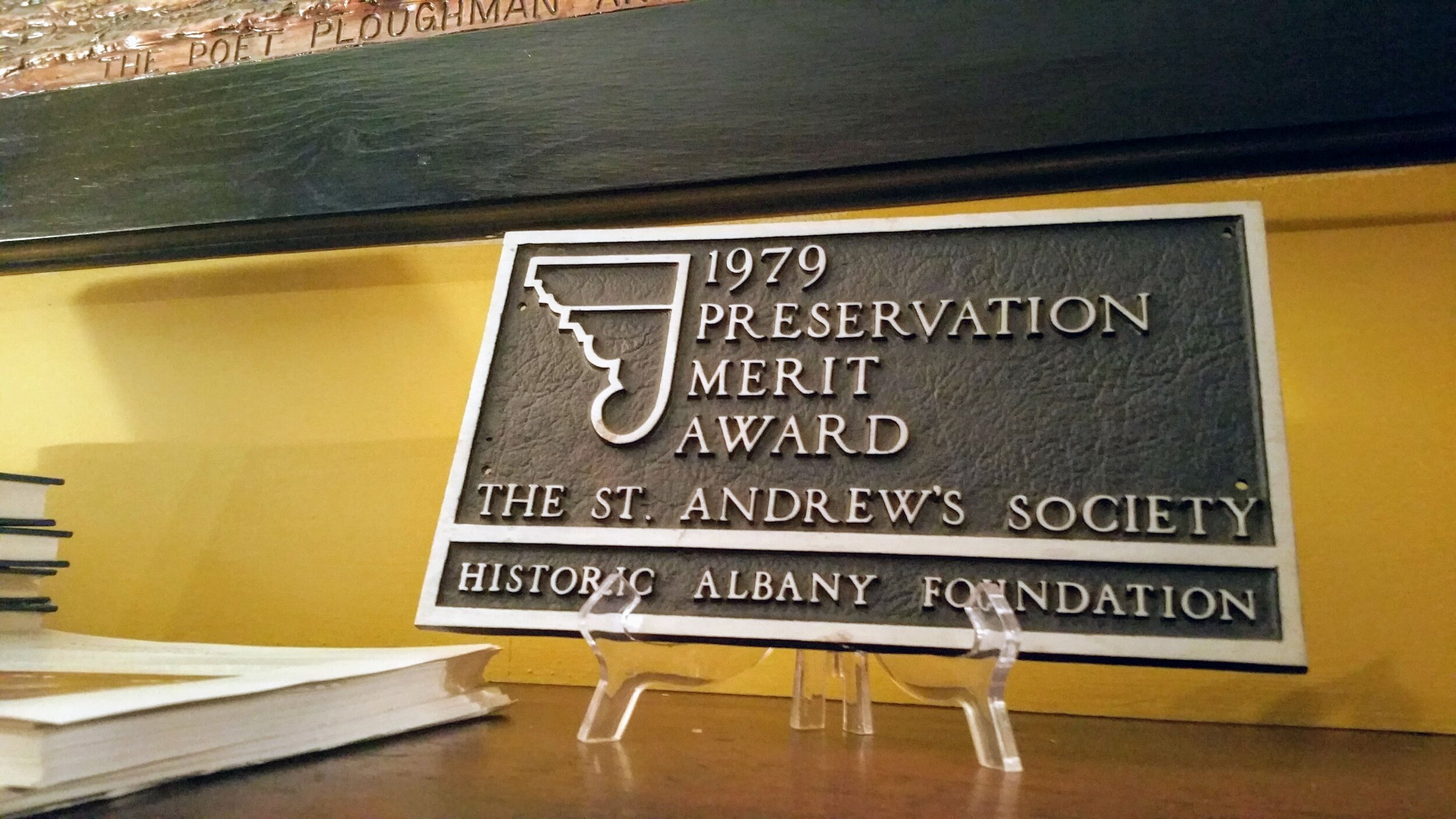
St. Andrew's Society History

The St. Andrew’s Society of Albany, NY was founded over 200 years ago in 1803., starting with 18 men of Scottish origin who wished to help their fellow descendants and be of “productive of good in the city”. Initially their activities were centered around welcoming and assisting with new arrivals of a Scots background, eventually filling the organization with a wide variety of members of different backgrounds. Their overall purpose? “To relieve the distressed” quietly without saying. Since then the society has participated and supported a variety of charitable causes and activities - including hosting Historic Albany Foundation’s Washington Avenue Celebration.

“The Rooms”

The St. Andrew’s Society has occupied the building at 150 Washington Ave since 1928, but the story of the building stretches further into the past. Built in 1891, this three-story brownstone was originally the home of James McKinney (co-owner of a local iron manufacturing company) . It was designed by Edward Ogden and Sons as a residence. Upon purchase, the Society completely refurbished the first and second floors, designed by David C. Lithgow.

First Floor

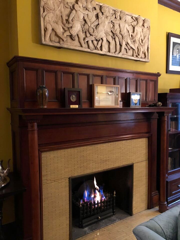
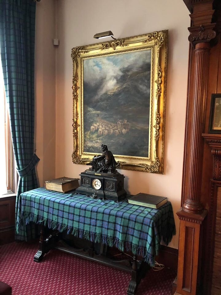
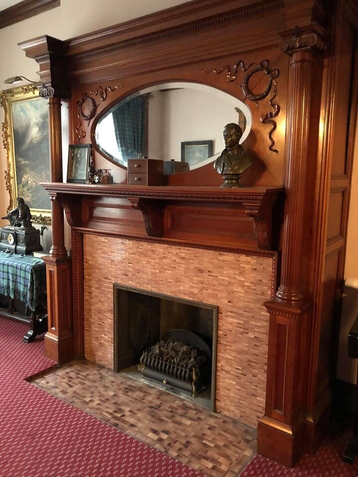
Parlor - Furnished in an 1890’s style, visitors can see photographs of past presidents of the society displayed.

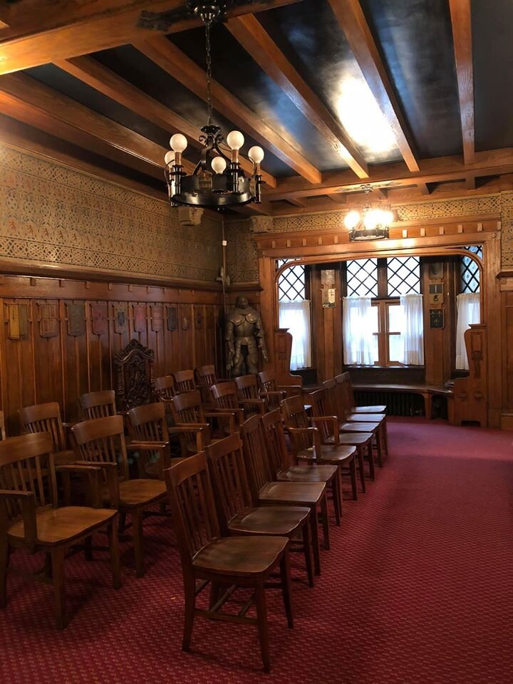
Assembly Hall

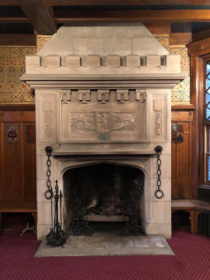
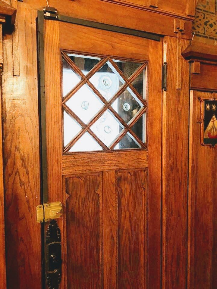
An “oak-beamed room with ceiling of blue” (D. Lithgow) complete with shields of Scottish clans and spun glass Jacobite windows - as well as a replica stone mantel, based on those commonly found in Scottish castles.

Stairway and Second Hall

Shows an exhibition of David Lithgow’s art and bronzed based reliefs of Signers of the Declaration of Independence by Charles Calverly.

Second Floor

Library

2,000 volumes of Scottish subjects

Rams Head Mull (gift of British War Relief Society in 1942)

Book Cases given by State Senator Curtis Douglas

Four Bronzed Panel (duplicates of those found on the Burns Monument)

King Alexander III Penny

Wee Kitchen

Fireplace - replica of one found i the Burns Corttege in Alloway, Ayrshire.

Curling Club Badges (late 19th Century)

Wednesday, 26 February 2020 from 17:30-19:30 / free event